
多边形
用法
let data = {
    "type": "FeatureCollection",
    "features": [
        {
            "id": "1",
            "type": "Feature",
            "properties": {
                "name": "polygon1",
                "color": "#00ffff"
            },
            "geometry": {
                "coordinates": [
                    [
                        [
                            3006.0952985307595,
                            15198.972934052355
                        ],
                        [
                            12606.64046359223,
                            9285.59366571666
                        ],
                        [
                            4745.324495099878,
                            3720.060236694666
                        ],
                        [
                            3006.0952985307595,
                            15198.972934052355
                        ]
                    ]
                ],
                "type": "Polygon"
            }
        },
        {
            "id": "2",
            "type": "Feature",
            "properties": {
                "name": "polygon2",
                "color": "#ff00ff"
            },
            "geometry": {
                "coordinates": [
                    [
                        [
                            19841.833921319492,
                            13807.589576796912
                        ],
                        [
                            19841.833921319492,
                            4207.0444117340885
                        ],
                        [
                            26172.62819683108,
                            4207.0444117340885
                        ],
                        [
                            26172.62819683108,
                            13807.589576796912
                        ],
                        [
                            19841.833921319492,
                            13807.589576796912
                        ]
                    ]
                ],
                "type": "Polygon"
            }
        }
    ]
}
let polygon = new vjmap.Polygon({
    data: map.toLngLat(data), // CAD几何坐标转渲染经纬度
    fillColor: ['case', ['to-boolean', ['feature-state', 'hover']], 'red', ['get', 'color']],
    fillOpacity: 0.8,
    fillOutlineColor: "#f00",
    isHoverPointer: true,
    isHoverFeatureState: true
});
polygon.addTo(map);
polygon.clickLayer(e => map.logInfo(`您点击了第 ${e.features[0].id} 个,名称为 ${e.features[0].properties.name},颜色为 ${e.features[0].properties.color} `))
polygon.hoverPopup(f => `<h3>ID: ${f.properties.name}</h3>Color: ${f.properties.color}`, { anchor: 'bottom' });
在沙箱中运行,调用唯杰地图公共演示服务
let svc = new vjmap.Service(env.serviceUrl, env.accessToken)
// 打开地图
let res = await svc.openMap({
    mapid: "sys_hello", // 地图ID
    mapopenway: vjmap.MapOpenWay.GeomRender, // 以几何数据渲染方式打开
    style: vjmap.openMapLightStyle() // div为深色背景颜色时,这里也传深色背景样式
})
if (res.error) {
    // 如果打开出错
    showError(res.error)
    return;
}
// 获取地图范围
let mapBounds = vjmap.GeoBounds.fromString(res.bounds);
// 根据地图范围建立几何投影坐标系
let prj = new vjmap.GeoProjection(mapBounds);
//
// 地图对象
let map = new vjmap.Map({
    container: 'map', // DIV容器ID
    style: svc.rasterStyle(), // 样式,这里是栅格样式
    center: prj.toLngLat(mapBounds.center()), // 设置地图中心点
    zoom: 1, // 设置地图缩放级别
    pitch: 0,
    renderWorldCopies: false // 不显示多屏地图
});
// 关联服务对象和投影对象
map.attach(svc, prj);
await map.onLoad();
let data = {
    "type": "FeatureCollection",
    "features": [
        {
            "id": "1",
            "type": "Feature",
            "properties": {
                "name": "polygon1",
                "color": "#00ffff"
            },
            "geometry": {
                "coordinates": [
                    [
                        [
                            3006.0952985307595,
                            15198.972934052355
                        ],
                        [
                            12606.64046359223,
                            9285.59366571666
                        ],
                        [
                            4745.324495099878,
                            3720.060236694666
                        ],
                        [
                            3006.0952985307595,
                            15198.972934052355
                        ]
                    ]
                ],
                "type": "Polygon"
            }
        },
        {
            "id": "2",
            "type": "Feature",
            "properties": {
                "name": "polygon2",
                "color": "#ff00ff"
            },
            "geometry": {
                "coordinates": [
                    [
                        [
                            19841.833921319492,
                            13807.589576796912
                        ],
                        [
                            19841.833921319492,
                            4207.0444117340885
                        ],
                        [
                            26172.62819683108,
                            4207.0444117340885
                        ],
                        [
                            26172.62819683108,
                            13807.589576796912
                        ],
                        [
                            19841.833921319492,
                            13807.589576796912
                        ]
                    ]
                ],
                "type": "Polygon"
            }
        }
    ]
}
let polygon = new vjmap.Polygon({
    data: map.toLngLat(data), // CAD几何坐标转渲染经纬度
    fillColor: ['case', ['to-boolean', ['feature-state', 'hover']], 'red', ['get', 'color']],
    fillOpacity: 0.8,
    fillOutlineColor: "#f00",
    isHoverPointer: true,
    isHoverFeatureState: true
});
polygon.addTo(map);
// 点击事件
polygon.clickLayer(e => map.logInfo(`您点击了第 ${e.features[0].id} 个,名称为 ${e.features[0].properties.name},颜色为 ${e.features[0].properties.color} `))
// hover事件
polygon.hoverPopup(f => `<h3>ID: ${f.properties.name}</h3>Color: ${f.properties.color}`, { anchor: 'bottom' });
也可以用先单独创建数据源,再创建填充图层的写法,如
map.addSource("fillSources", {
    type: "geojson",
    data: data
});
map.addLayer({
    id: 'fillLayers',
    source: 'fillSources',
    type: 'fill',
    "layout": {},
    "paint": {
        "fill-color": ['case', ['to-boolean', ['feature-state', 'hover']], 'red', ['get', 'color']], //颜色
        'fill-opacity': 0.8,
        'fill-outline-color': "#f00"
    }
})
或 属性用驼峰式大小写,不用区分layout还是paint属性
map.addGeoJSONSource("fillSources", data);
map.addFillLayer("fillLayers", "fillSources", {
    fillColor: ['case', ['to-boolean', ['feature-state', 'hover']], 'red', ['get', 'color']], //颜色
    fillOpacity: 0.8,
    fillOutlineColor: "#f00"
})
这种通过创建数据源和图层的写法,响应事件时,需要监听地图的图层事件进行处理
map.on("click", layerId, e => {})
常用方法
修改数据用 setData
polygon.setData(newDataJson);
获取图层ID、数据源ID
// 获取图层ID
polygon.getLayerId()
// 获取数据源ID
polygon.getSourceId()
显示或隐藏
// 显示
polygon.show()
// 隐藏
polygon.hide()
删除
// 删除
polygon.remove()
相关示例
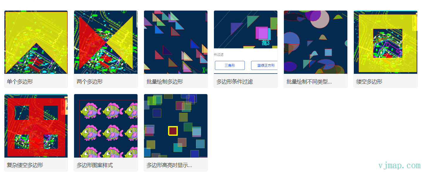
类型定义
/**
 * 创建多边形.
 *
 **/
export  class Polygon extends OverlayLayerBase {
    options: PolygonOptions;
    constructor(options: PolygonOptions);
    addTo(map: Map, beforeId?: string): void;
    /** 替换 GeoJSON 图层的当前数据。
     @param {GeoJSON} [data] GeoJSON object to set. If not provided, defaults to an empty FeatureCollection.
     */
    setData(data: PointGeoJsonInput | PointGeoJsonInput[] | GeoJsonGeomertry | GeoPointLike | any): void;
    /** 为一层或多层设置`fill-sort-key`布局属性。 */
    setFillSortKey(value: DataDrivenPropertyValueSpecification<number>): this;
    /** 为一个或多个图层设置`fill-antialias` 绘制属性。 */
    setFillAntialias(value: PropertyValueSpecificationEx<boolean>): this;
    /** 为一个或多个图层设置`fill-opacity` 绘画属性。 */
    setFillOpacity(value: DataDrivenPropertyValueSpecification<number>): this;
    /** 为一个或多个图层设置`fill-color` 绘画属性。 */
    setFillColor(value: DataDrivenPropertyValueSpecification<ColorSpecification>): this;
    /** 为一个或多个图层设置`fill-outline-color` 绘画属性。*/
    setFillOutlineColor(value: DataDrivenPropertyValueSpecification<ColorSpecification>): this;
    /** 为一个或多个图层设置`fill-translate` 绘制属性。 */
    setFillTranslate(value: DataDrivenPropertyValueSpecification<ResolvedImageSpecification>): this;
    /** 为一个或多个图层设置`fill-translate-anchor` 绘制属性。 */
    setFillTranslateAnchor(value: PropertyValueSpecificationEx<"map" | "viewport">): this;
    /** 为一个或多个图层设置`fill-pattern` 绘制属性。 */
    setFillPattern(value: DataDrivenPropertyValueSpecification<ResolvedImageSpecification>): this;
    /** 获取图层的`fill-sort-key` 布局属性. */
    getFillSortKey(): DataDrivenPropertyValueSpecification<number>;
    /** 获取图层的“填充抗锯齿”绘制属性。 */
    getFillAntialias(): PropertyValueSpecificationEx<boolean>;
    /** 获取图层的 `fill-opacity` 绘制属性。 */
    getFillOpacity(): DataDrivenPropertyValueSpecification<number>;
    /** 获取图层的 `fill-color` 绘制属性。 */
    getFillColor(): DataDrivenPropertyValueSpecification<ColorSpecification>;
    /** 获取图层的 `fill-outline-color` 绘制属性。 */
    getFillOutlineColor(): DataDrivenPropertyValueSpecification<ColorSpecification>;
    /** 获取图层的 `fill-translate` 绘制属性。 */
    getFillTranslate(): PropertyValueSpecificationEx<[number, number]>;
    /** 获取图层的 `fill-translate-anchor` 绘制属性。 */
    getFillTranslateAnchor(): PropertyValueSpecificationEx<"map" | "viewport">;
    /** 获取图层的`fill-pattern` 绘制属性。 */
    getFillPattern(): DataDrivenPropertyValueSpecification<ResolvedImageSpecification>;
}


export  class OverlayLayerBase {
    sourceId?: string;
    layerId?: string;
    _map?: Map;
    constructor();
    addTo(map: Map, beforeId?: string): void;
    /**
     * 获取数据源ID
     * @return {string | undefined}
     */
    getSourceId(): string | undefined;
    /**
     * 获取图层ID
     * @return {string | undefined}
     */
    getLayerId(): string | undefined;
    /**
     * 获取数据源的数据
     * @return {GeoJsonGeomertry | undefined}
     */
    getData(): GeoJsonGeomertry | undefined;
    remove(): void;
    /** 每当鼠标悬停在这些图层上时,将地图的光标设置为“指针”。
     @returns A function to remove the handler.
     * @param layerOrLayers
     */
    hoverPointer(): void;
    /**
     每当将鼠标悬停在这些图层中的某个特征上时,更新连接源 [s] 中特征的特征状态。
     * @param enterCb
     * @param leaveCb
     */
    hoverFeatureState(enterCb?: (arg0: {}) => void, leaveCb?: (arg0: {}) => void): void;
    /** 将鼠标悬停在这些图层中的某个要素上时,会显示一个弹出窗口。
     @param htmlFunc Function that receives feature and popup, returns HTML.
     @param {Object<PopupOptions>} popupOptions Options passed to `Popup()` to customise popup.
     @example hoverPopup(f => `<h3>${f.properties.Name}</h3> ${f.properties.Description}`, { anchor: 'left' });
     */
    hoverPopup(htmlFunc: any, popupOptions?: PopupOptions): any;
    /** 每当单击这些图层中的要素时都会显示一个弹出窗口。
     @param htmlFunc Function that receives feature and popup, returns HTML.
     @param {Object<PopupOptions>} popupOptions Options passed to `Popup()` to customise popup.

     @returns A function that removes the handler.
     @example clickPopup(f => `<h3>${f.properties.Name}</h3> ${f.properties.Description}`, { maxWidth: 500 });

     */
    clickPopup(htmlFunc: (arg0: {}) => void, popupOptions?: PopupOptions): any;
    /** 每当单击这些图层中的要素时都会触发回调。
     @param {function} cb Callback that receives event with .features property
     @returns A function that removes the handler.
     */
    clickLayer(cb: any): any;
    /** 当鼠标悬停在这些图层中的要素上时触发回调。
     @returns A function to remove the handler.
     */
    hoverLayer(cb: any): any;
    /**
     * 使给定的图层可见。
     * @param layer
     */
    show(): void;
    /**
     * 使给定的图层不可见。
     * @param layer
     */
    hide(): void;
    /** 根据参数使给定的图层隐藏或可见。
     @param {boolean} state True for visible, false for hidden.
     */
    toggle(state: boolean): boolean;
    /** 在一个或多个图层上设置绘制或布局属性。
     @example setProperty('fillOpacity', 0.5)
     */
    setProperty(prop: string | object, value?: any): void;
    /** 根据样式规范,获取给定图层 ID 的图层定义。
     */
    getLayerStyle(): LayerSpecification;
    /**
     * 设置图层样式
     * @param layer
     * @param style
     */
    setLayerStyle(style: any): void;
    /** 替换一个图层的过滤器。
     @param {Array} filter New filter to set.
     @example setFilter(['==','level','0']]);
     */
    setFilter(filter: FilterSpecification): void;
}

export  interface OverlayLayerBaseOptions {
    sourceId?: string;
    sourceLayer?: string;
    layerId?: string;
    minzoom?: number;
    maxzoom?: number;
    filter?: any;
    visibility?: "visible" | "none";
    isHoverPointer?: boolean;
    isHoverFeatureState?: boolean;
}


export  type FillLayerSpecification = {
    id: string;
    type: "fill";
    metadata?: unknown;
    source: string;
    "source-layer"?: string;
    minzoom?: number;
    maxzoom?: number;
    filter?: FilterSpecification;
    layout?: {
        "fill-sort-key"?: DataDrivenPropertyValueSpecification<number>;
        visibility?: "visible" | "none";
    };
    paint?: {
        "fill-antialias"?: PropertyValueSpecificationEx<boolean>;
        "fill-opacity"?: DataDrivenPropertyValueSpecification<number>;
        "fill-color"?: DataDrivenPropertyValueSpecification<ColorSpecification>;
        "fill-outline-color"?: DataDrivenPropertyValueSpecification<ColorSpecification>;
        "fill-translate"?: PropertyValueSpecificationEx<[number, number]>;
        "fill-translate-anchor"?: PropertyValueSpecificationEx<"map" | "viewport">;
        "fill-pattern"?: DataDrivenPropertyValueSpecification<ResolvedImageSpecification>;
    };
};

export  type FillLayerStyleProp = {
    metadata?: unknown;
    source?: string;
    sourceLayer?: string;
    minzoom?: number;
    maxzoom?: number;
    filter?: FilterSpecification;
    visibility?: "visible" | "none";
    fillSortKey?: DataDrivenPropertyValueSpecification<number>;
    fillAntialias?: PropertyValueSpecificationEx<boolean>;
    fillOpacity?: DataDrivenPropertyValueSpecification<number>;
    fillColor?: DataDrivenPropertyValueSpecification<ColorSpecification>;
    fillOutlineColor?: DataDrivenPropertyValueSpecification<ColorSpecification>;
    fillTranslate?: PropertyValueSpecificationEx<[number, number]>;
    fillTranslateAnchor?: PropertyValueSpecificationEx<"map" | "viewport">;
    fillPattern?: DataDrivenPropertyValueSpecification<ResolvedImageSpecification>;
};

export  type FilterSpecification = ["has", string] | ["!has", string] | ["==", string, string | number | boolean] | ["!=", string, string | number | boolean] | [">", string, string | number | boolean] | [">=", string, string | number | boolean] | ["<", string, string | number | boolean] | ["<=", string, string | number | boolean] | Array<string | FilterSpecification>;
这篇文档有帮助吗?感谢反馈!